There are many important rules to remember when hiking in the backwoods; but none so more important as choosing a partner who is more attractive to insects than yourself. On this hike, Wayne came away with four ticks while I had none...mission accomplished. Other important information for this hike to the headwaters of Roaring Brook is to wear waterproof shoes and apply liberal quantities of a quality insect repellant.
We parked at the Basin road trail head at the Vernon Municipal Forest and proceeded through the gate and up the town forest road towards the Roaring Brook Wildlife Management Area. We continued straight (west) on the forest road, keeping the big swamp to our left and hiked past the "trail closed" signs and into RBWMA.
Note: the trail closed signs were posted by VAST and are posted to direct snowmobiles away from this area. Foot traffic is still permitted on this trail. The question is, do you like mud?
Looking at Wayne's On X image below, the Basin Road trailhead enters the picture on the lower right of the image. We first hiked up the right side of the image from the green section which marks the Vernon Town Forest past the white horizontal line that identifies the state owned lands of RBWMA. The Roaring Brook is shown as a darker solid blue line and tributaries are shown in broken blue lines in the same shade of darker blue. Our hike is shown by the light blue broken line.
The water in this area is positively teaming with life.
Spring flowers have begun to arrive.
The Efts were so plentiful that it takes concerted effort to avoid stepping on them. I took two pictures to illustrate their color variations. Efts may be red, orange or a brownish color. After their second metamorphosis they are yellowish-green aquatic adults.
I never become tired of discovering variations in moss in the town forest and the RBMA
Is it just me, or does this mushroom growing on a living White Pine tree look like a face both upright and upside down?
I failed to mention that the reason we decided on this hike is because Claire and Gregg invited us to hike
Taconic Ramble Mountain state park. This is Vermont's newest state park and is listed as, "challenging terrain." Basically, we need to get some more miles in between now and then.
Eastern Mountain Laurel is a native evergreen shrub that blooms in late May to early June. The town forest will be filled with white blossoms during this time.
Today (May 15th)
Hobblebush, a native Viburnum is in bloom.
On one side of the trail there is little to no ground cover for wildlife.
Directly on the opposite side of the trail, there is green. An old logging trail blockaded with logs may hold the reason why.
In the middle is mud.
Some things never seem to improve. We hiked this muddy section of trail a few years ago and vehicles degrade this area still.
Some hikers don't mind the mud.
Mud and bugs aren't exactly Wayne's favorite trail conditions. He is a good sport however and so we slog through. When telling my mother about our hike she remarked, "Don't tell people to go there."
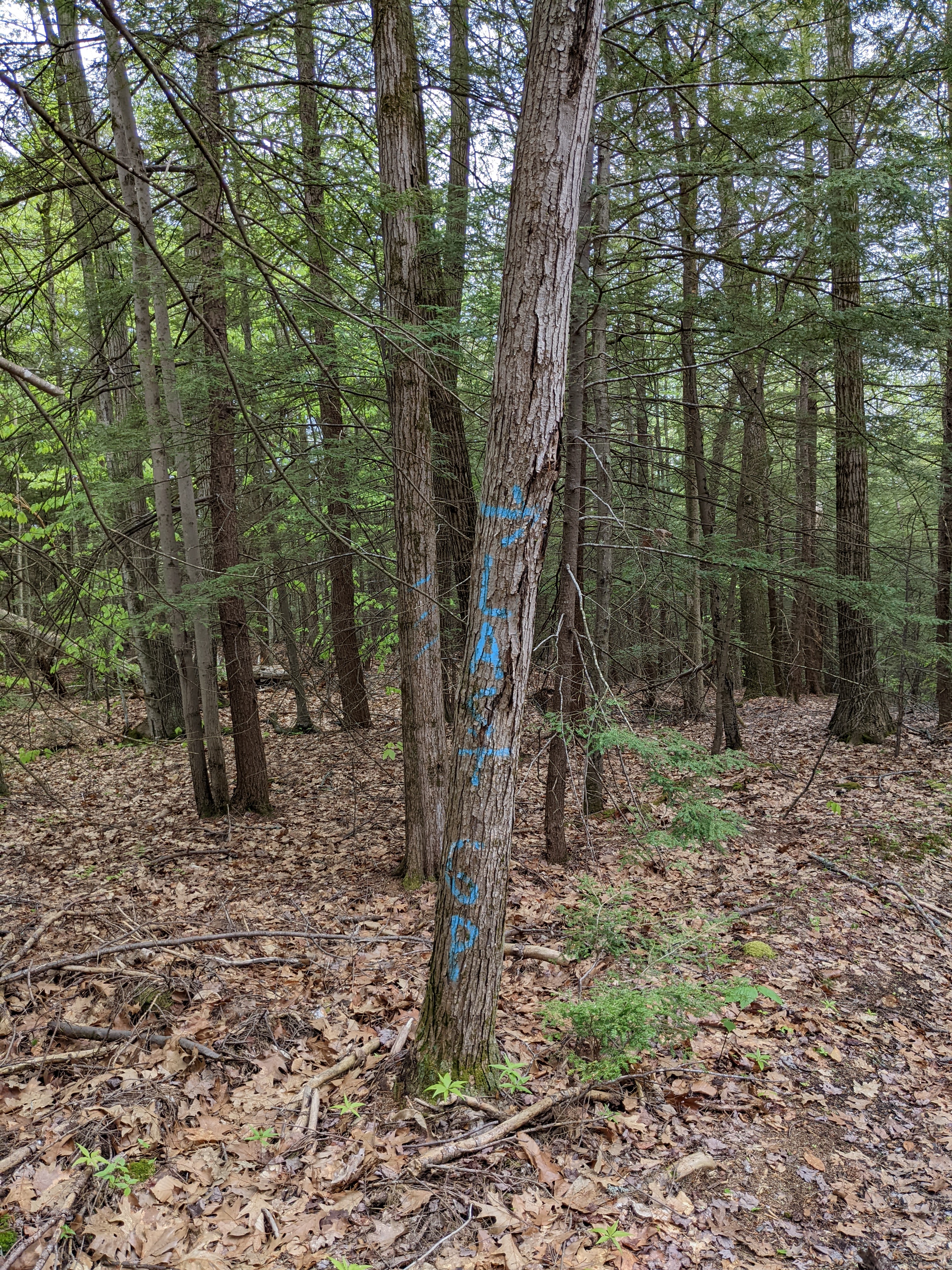
This tree marks the state land boundary.
Boulders have been laid across the trail to prevent motorized vehicles from entering state lands.
There is always a way.
I remember why we turned back years ago.
This area looks to be logged in striations (think tiger stripes).
Saplings take advantage of increased light.
I failed to notice the condition of the two trees behind this American Beech until I reviewed the picture.
This boulder appears to be an erratic deposited by glaciers; but with so much logging activity it's also possible that it was brought here by trucks.
Finally dry trail ahead!
Signs of a working landscape are everywhere.
There is a balance to be considered and achieved here. On the one hand logging increases brows for deer and the like. On the other hand, old growth is required habitat for wildlife such as the Piliated Woodpecker.
One constant, biting insects, exists here.
Something has been enjoying dining on or at this tree. My hunch is that it's a porcupine.
When searching for water, I suppose one should expect to find some; but why is it always in the middle of the trail?
Perhaps bring hip waders too.
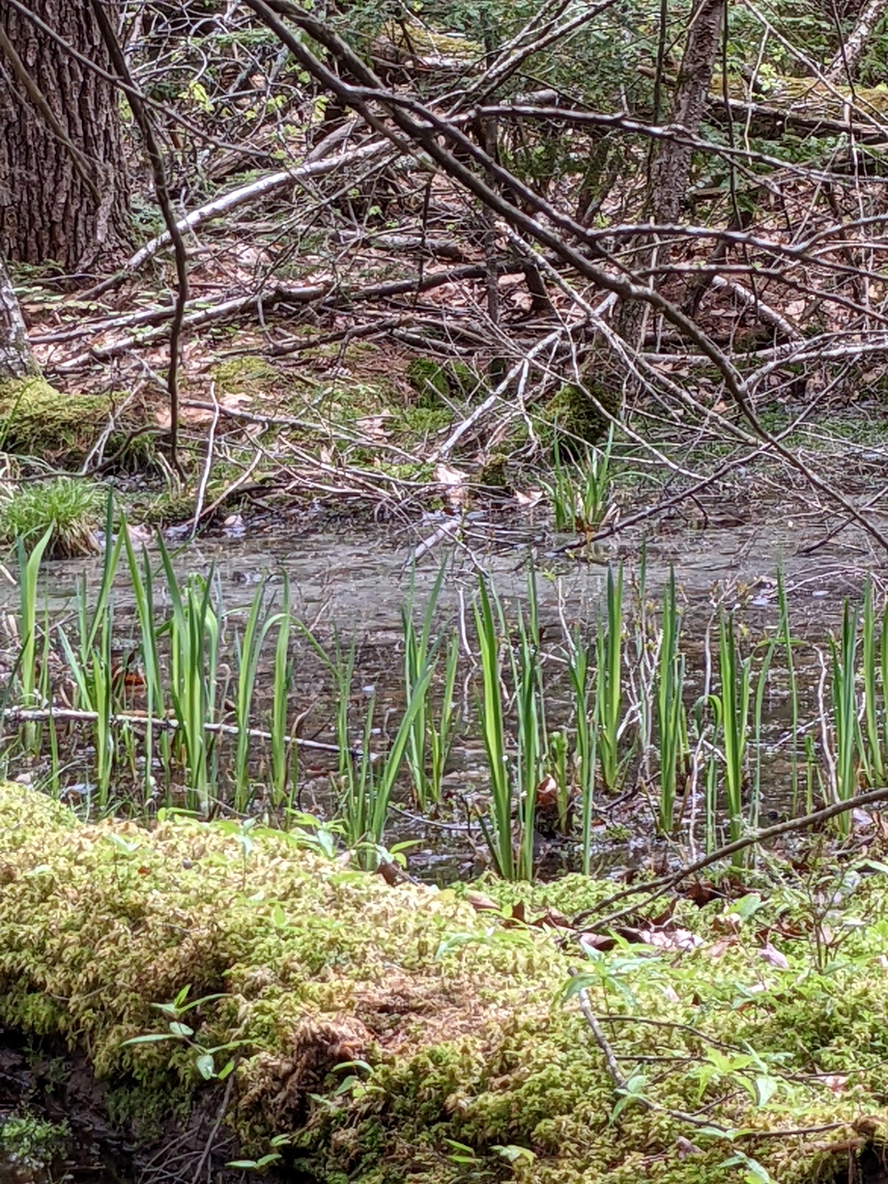
Once a friend expressed concern that the new sign at the Basin trailhead depicted cattails when in fact the town forest has none. I can't resist getting a little extra muddy to capture this picture of cattails in the RBWMA.
Just beyond the swamp is the surveyed boundary between state lands and the Kuhn Licia Divona parcel.
Even the bypasses are flooded.
There is a small open area which serves as a three way intersection. Here is what looks to be an old cellar hole, a VAST marker and the place where Wayne claims that the map shows the Roaring Brook headwaters.
The only issue being that the streambed is dry.
Can I interest you in a black cherry tree or unique tree partnerships instead?
It's ridiculous to be searching for water at this point in our hike.
Red blazes on the tree line tell us that we have reached the lower boundary.
Wayne's OnX map shows that just south of the RBWMA line we will cross the Roaring Brook.
A new VAST bridge has been built over the Roaring Brook in this location. On previous hikes Wayne and I waded through this area.
You are still getting a bath Ginny!
It's all uphill from here to the town forest and the Stateline Trail. Sometimes we aren't entirely sure if we have reached our goals. The map says yes so I suppose that's good enough.
-Norma Manning


.jpg)


No comments:
Post a Comment